I expect mail on this, but Hudson’s most valuable wetland isn’t Sandy Beach or Como Bog — and it isn’t even in Hudson. It’s the 100-hectare wilderness of forests, ravines, marshes and fens lying between Highway 40 to the south and Harwood Blvd. (Hwy 342) to the north. This is the Upper Viviry watershed and catchment basin, source of Hudson’s drinking water — and the recipient of ever-increasing runoff from new residential development in St. Lazare and Vaudreuil-Dorion.
The Upper Viviry is part of the Viviry/ Black Creek watershed, 14.5 square kilometres stretching through three municipalities. Its headwaters are three branches fed by springs and marshes in the forested wetlands reaching as far south as rue Ste. Angèlique in St. Lazare, from past Camping Daoust to the east and Montée Alstonvale in Vaudreuil-Dorion’s Fief sector.
The Viviry flows northeast under Hwy 342 into Hudson’s Viviry Conservation Area, past Whitlock’s links and under Cote St. Charles, through Bradbury Park into what was Pine Lake on its journey to the Sandy Beach estuary and the Lake of Two Mountains. Over that last mile, the Viviry’s flow is increased by drainage from ravines and wetlands extending along the escarpment between Montée Lavigne in Hudson’s west end and Bellevue in the east.
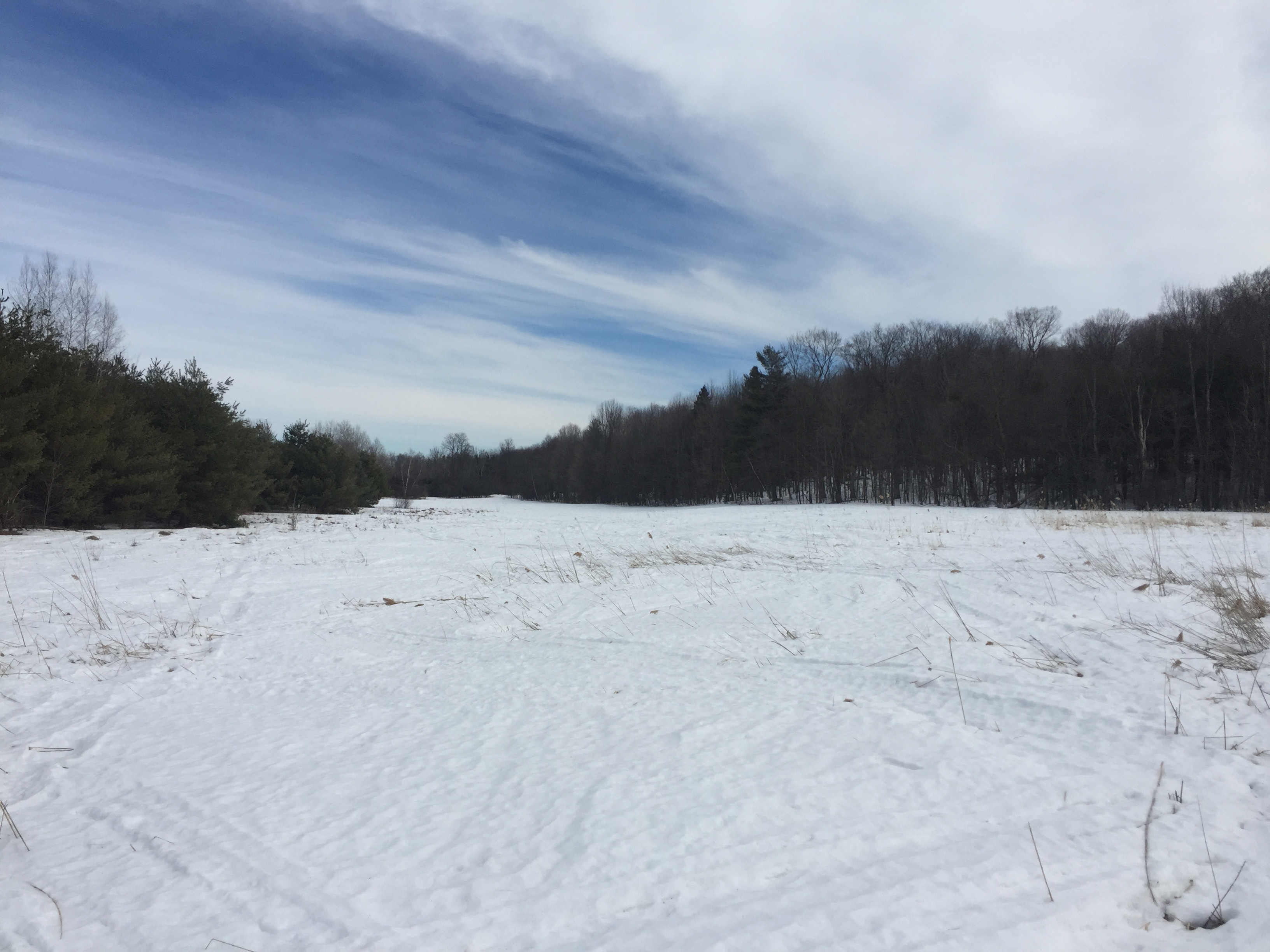
The Upper Viviry basin probably looks like it did when Cumberland settlers colonized the region in the first part of the 19th century. It’s accessible only in winter, and for the most part only on back-country skis or snowshoes. But civilization has encroached over the 60 or so years since I first explored its reaches. The tracks of unauthorized snowmobiles and ATVs stitch the the frozen marsh. To the northwest looms the sewage treatment plant where Habitations Robert is building the first 294 homes of the multiphase Ravin Boisé development on what was once a working farm and sugarbush. The southeastern corner, a mix of woodlots and grasslands behind Mon Village, is zoned for a major residential/commercial project with its own sewage treatment plant.
Crossing Highway 342 into Hudson, sections like the upper Viviry and Hudson’s Viviry Conservation Area remain relatively pristine. The stretch between the Bradbury Nature Trail and Cameron is in the process of re-wilding in the wake of the 2014 Pine Lake dam failure. Given the length of time since Pine Lake became Pine Flats and the ongoing political debate over what to do, it is increasingly unlikely that the lake will be rebuilt to its original dimensions.
Between Cameron and Main, the Viviry is in rough shape. Fallen trees, junk and generations of illegal dumping inpede its flow. Instead of the shoreline vegetation one finds on its upper reaches, erosion caused by unchecked high-water periods has turned the lower Viviry’s banks into mud flats. The growth of trash trees like Manitoba maples and willows cuts sunlight that bank-repairing, pollution-filtering species would need to thrive. Ecologically, the urbanized, canalized lower Viviry is a wasteland instead of an eco-corridor. This is being addressed in draft bylaws 525.3 and 750 but will depend on buy-in from property owners who will no longer be permitted to do whatever they want in their back yards.
I’ve already written extensively on the Viviry between Main and the Ottawa River, but to summarize, both banks are within the 60% placed under conservation as part of the development agreement with its owners. Ironically, the estuary, once home to flocks of shore-dwelling birds and mammals, has been trampled into desolate mud flats by hordes of day trippers looking for a place to camp and run their dogs. The adjacent wetlands are filled with garbage, scrapped appliances and junked industrial machinery from the former Wilson Company icehouse.
Exploring the Upper Viviry
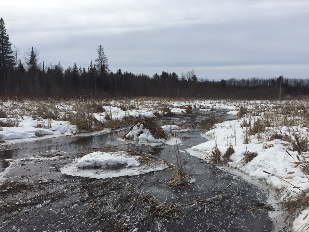
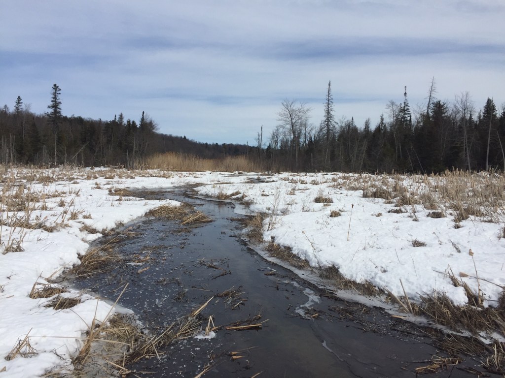
In mid-March 2021, our hiking friends Denis and Frances joined Louise and I for a trek through the Upper Viviry catchment basin. Between the start of mosquito season and the first frost, this square kilometre is unbearably buggy; late winter is the ideal time to explore.
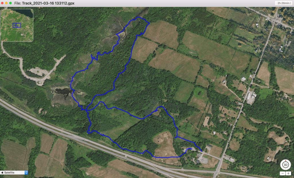
I carried a Garmin GPSMap 78s to generate a GPX track of our hike I could overlay onto cadastral and zoning maps. It allows the user to compare what’s on the ground with municipal and agricultural zoning and land use maps, cadastral records, municipal boundaries and other information.
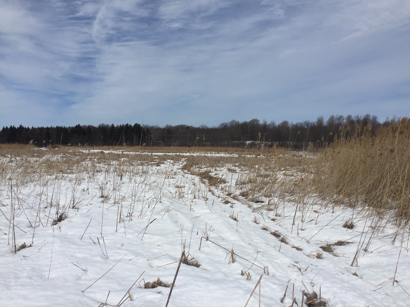
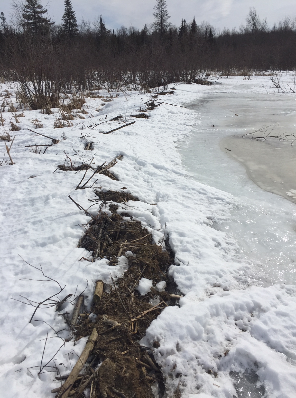
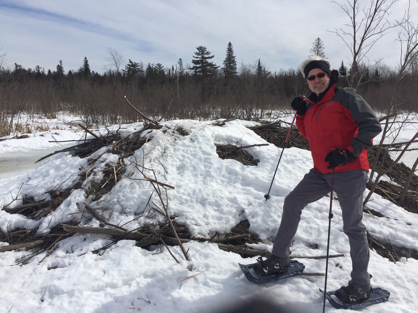
The four of us were awed by the vastness of the wetlands. We crossed beaver dikes hundreds of metres long and took selfies with condo-sized beaver lodges. We bushwacked through old-growth forests of maple, oak, hickory, hemlock, cedar, pine, fir and spruce where we identified tracks of coyote, lynx and fisher. We startled a sizeable herd of whitetail deer. Overhead, raptors circled.
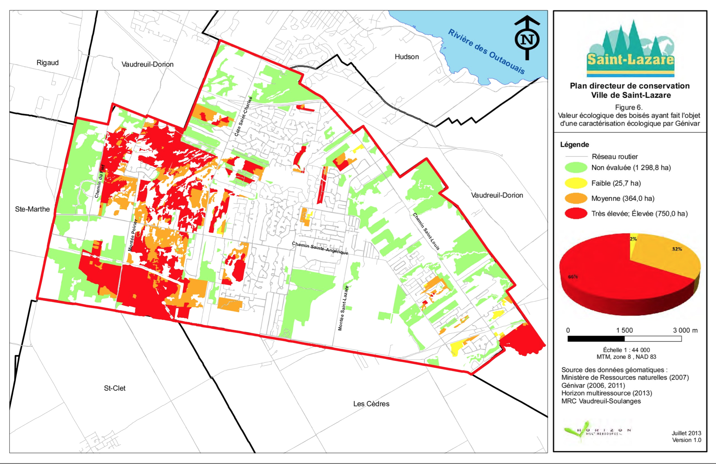
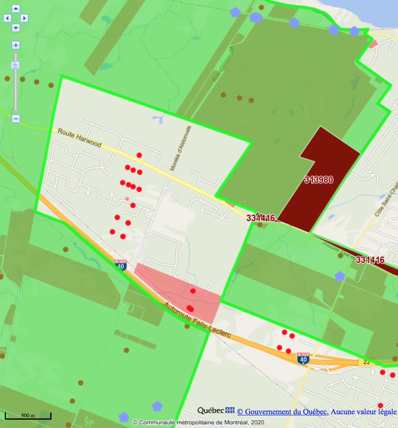
Later, I overlaid our track onto the aquifer map contained in the 2015 PACES analysis (more below). Much of where we walked lies within the replenishment area for the aquifer which supplies Hudson its water. Despite its size and importance to the aquifer, the wetland is not designated as protected in St. Lazare’s conservation plan, below left. At lower right, Commission de protection du territoire agricole (CPTAQ) zoning allows residential and commercial development on the par 3 golf course behind Mon Village you can see as the cluster of buildings just above the Exit 22 cloverleaf. This project, along with the pink Habitations Robert development to the west, would hug the southern edge of the Viviry watershed.
What we see of the Viviry and its tributaries is mirrored by another Viviry dozens or hundreds of feet below the surface, an invisible river flowing slowly through layers of silt, clay, sand and gravel laid down during the last glaciation 11,000 years ago. That underground Viviry — and aquifers like it — supply close to half of all the drinking water in Vaudreuil-Soulanges and its 150,000 residents, including all of Hudson, St. Lazare and Rigaud.
Ours is the largest region by population in Quebec dependent on underground aquifers for its drinking water, yet we know next to nothing about their capacity or recharge rates. The only numbers we have are for municipal consumption; figures for the volume of water drawn by private wells are guesstimates. Quebec’s 2008 regulation designed to monitor the quantity of water being drawn from a given aquifer is a pretense of control that fools nobody.
By 2010, Vaudreuil-Dorion, St. Lazare, Hudson and Rigaud were all dealing with chronic drinking-water issues — stressed or failing municipal wells, boil-water advisories, watering bans, even total exterior-use bans. (St. Lazare went to court to defend the right to keep water-consumption statistics secret so as not to slow the rate of development.)
It was at this point that retired hydrologist Gabriel Meunier and a group of concerned individuals created the Conseil des bassins versants de Vaudreuil-Soulanges (COBAVER-VS), a non-governmental organization with a mandate to study the region’s water sources with funding from the MRC and the environment ministry’s Programme d’acquisition de connaissance sur les eaux souterraines (PACES) and technical support from geomapping consultants Géomont. Over the next three years, an 20-person interdisciplinary team from the Université du Québec à Montréal (UQAM) gathered the data required to model our region’s aquifers.

Published in 2015, the PACES/UQAM study established that the plateaus in St. Lazare and Hudson are critical aquifer replenishment zones, vulnerable to pollution and hardscaping which reduce permeability. Their recommended protection measures: allowing only low-density (less than eight units per hectare) residential development and conserving the complex of wetland corridors.
Key points:
— 54% of all drinking water consumed in Vaudreuil-Soulanges originates from the Mont Rigaud highlands (9%) and the Hudson and St. Lazare plateaus (41%).
— Local aquifers (eg the Viviry watershed) are most vulnerable to depletion; public and private wells draw down 29% of their natural replenishment.
— Hudson, Rigaud and St. Lazare depend entirely on underground water.
The report made special mention of a 2007 study by Gartner Lee Ltée. commissioned by concerned residents of St. Lazare’s west end. It found that wells on Ste. Angèlique and Fief need to be drilled progressively deeper to obtain sustainable water, raising the possibility that the aquifer in that part of St. Lazare is shrinking, either because of reduced replenishment or increased consumption. Fief residents have told me they had to drill up to 600 feet to ensure an adequate water supply.
PACES concluded with the recommendation that municipalities dependent on local aquifers must closely track consumption data before authorizing any new wells or allowing residential development based on water from the aquifer. It also warns that even if an aquifer appears to be productive, there is no way to measure long-term sustainability.
In the seven years since the PACES team published their report, emerging anecdotal evidence suggests that some aquifers in the region are stressed beyond their capacity by unregulated high-density residential development.
Earlier this month I got a call from Gary Dover, who lives on Harwood in Vaudreuil-Dorion west of the entrance to Hudson Valleys. Gary and Anita drink bottled water, but draw water for their household and garden from an 80-foot borehole well completed in 1990, the year before they purchased their house. With various modifications and a new pump, the system appeared to be working well until last year, when Gary’s seven-year-old pump showed signs of failure. The service technician identified the problem: their well was taking longer to replenish itself — a precursor to failure.
They learned neighbours were having similar problems with their wells regardless of depth or age. “Some of us have 80-foot artesian wells,” says Gary. “Others have 30-foot wells straight out of the 19th century.” Gary and neighbour Frank Delforge went door to door along Harwood and adjacent streets asking people whether they were having well issues. They found at least 40 others who were seeing signs of their wells failing over the past several months. When Gary told them that he and Anita were drinking and cooking with bottled water and boiling their well water for domestic uses, most said they were doing the same.
Dover contacted his district councillor Karine Lechasseur to discuss the problem and possible solutions. He said Lechasseur told him the city was aware of the problems residents were having with their wells and proposed a solution that would have Harwood households on private wells connect to a new west-end municipal water system fed by the city well at the corner of Harwood and Alstonvale. “She agreed it was a regional problem,” Dover told me, “and that the city would put it right, with consideration for the fact that this wasn’t our fault.”
I asked Lechasseur whether the city felt an official boil-water advisory was advisable for the sector. She told me she didn’t think the situation had reached the critical stage, but that Vaudreuil-Dorion’s director-general and staff were aware of the situation. One question she couldn’t answer is the sustainability of the aquifer, beginning with Vaudreuil-Dorion’s well at the corner of Harwood and Alstonvale that will supply Dover and his neighbours when and if they’re connected. Her understanding is that a municipality must apply for a certificate of authorization (CA) from the environment ministry to allow a sector to draw well water based on the number of homes and the working capacity of each well.
According to Dover, municipal employees have been working nonstop to ensure the well can supply increased demand from Ravin Boisé and adjacent developments. He finds it mind-boggling that the city would issue construction permits before ensuring it had a revised CA in hand, especially when the evidence suggests the aquifer may be showing early signs of stress.
While residents of the nearby Hudson Valleys and Alstonvale developments draw their water from municipal wells outside the affected area, some also have commissioned private wells to get around Hudson’s water-conservation regulations. Since the Environmental Quality Act was modified in 2008 to include the regulation of private wells, the Town of Hudson has issued 84 private-well permits for all sectors of town. I was told no numbers are available for the quantity of water extracted per well per day nor in which sector.
In principle, private wells require regulatory approval under a clause of the Environmental Quality Act, the Water Withdrawal and Protection Regulation, which sets standards for “water withdrawals, water withdrawal facilities and facilities or activities that may affect the quality of water withdrawn in the vicinity. It ensures, in particular, the protection of water withdrawn for human consumption or food processing purposes.”
The maximum daily amount of water that can be withdrawn by a private well is based on a 90-day average taken over a period of maximum water withdrawal (eg. a golf course well in summer) and the maximum number of users connected (20). Withdrawals cannot exceed 75 cubic metres (75,000 litres) per day.
My next call was to Vaudreuil-Dorion’s director-general, Olivier Van Nest, who shared his city’s long-term plan to connect all Harwood sectors currently on private or town wells (Hudson Acres, Domaine en haut, Normandie/Picardie/de la Concorde) to municipal water via a line up Montée Cadieux. The exception is Gary and Anita’s’s neighbourhood, separated from the rest of Vaudreuil-Dorion by the Viviry Valley. The solution there, Van Nest explained, is to connect them to the town’s Montée Alstonvale well — but only once data confirms the well is capable of supplying more water than the 600 cubic metres (600,000 litres) per day authorized by the current CA.
Can he be sure that aquifer can support a level of consumption required to supply several hundred new homes in the sector as well as hooking up those still on private wells? It’s up to the experts, Van Nest said. A similar process is underway to determine whether Vaudreuil-Dorion’s wells in southern St. Lazare have sufficient capacity to supply the network with the increased capacity required by the regional hospital scheduled to open in late 2026.
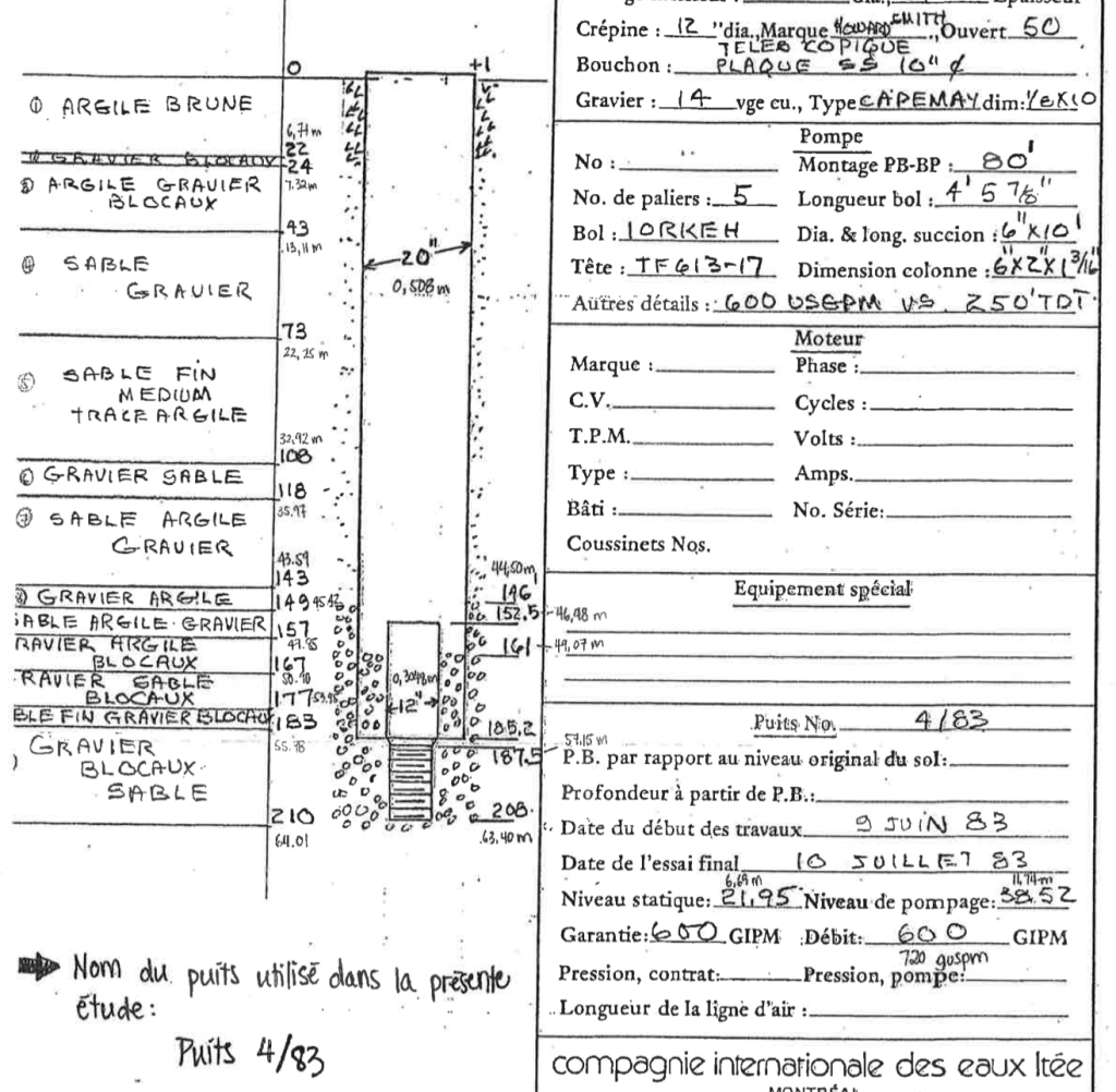
How does one determine the sustainability of Hudson’s aquifer? The latest attempt to answer this question was the 2018 Akifer study, one of the first contracts approved by the Nicholls council (residents will find the study posted on the town website). Below, the core paragraph (my translation):
In order to clarify whether the flow of the aquifer currently used by the Bradbury and 4/83 wells is capable of permitting the extraction of an additional flow, it will be necessary to provide, following the installation of new wells, an extended pumping period of one month during low-water periods to better document the behaviour of the pool under this constraint. It would also be preferable to have the shortfall period set during the summer to ensure that the Whitlock Golf Course well is also operated during the trial period, as the Whitlock Golf Course Golf Course Well uses the same aquifer as the Bradbury and 4/83 wells.
We know what is being produced and consumed from Hudson’s five operational wells (three in Bradbury Park, two in Hudsn Valleys/Alstonvale) because Quebec requires municipalities to monitor and post water consumption and test results. Hudson was negligent in doing so until 2017, when data first showed the municipality has a serious over-consumption problem. Over three days late last August, the main filtration plant on Woodland produced an average of more than 3,000 cubic metres of water a day — three million litres, or 596 litres a day for every one of the 5,033 residents on the two distribution networks it supplies.
Over that same period, the Mount Victoria filtration plant and reservoir serving Hudson’s Valleys and Alstonvale averaged 665 cubic metres (665,000 litres) a day for 263 residents — 2,528 litres per person. Losses due to leakage, arrived at by comparing daytime use with overnight baselines, was 70 cubic metres per day, or 10.5%. Quebec’s average usage is 385 litres per person per day. The provincial target for water loss due to leakage is 15%.

As kids, we swam in Pine Lake and explored the trails that ran along Black Creek. One of my goals, first as a newspaper editor, then as a councillor and now as an elder with a blog, has been to protect the Viviry, both as a natural area and as the source of Hudson’s water supply.
Sometimes those two missions have taken different paths. In 2017, the Citizens Action Group on Infrastructure, one of several advisory committees created by mayor Ed Prévost, produced the Source Report, a controversial analysis of Hudson’s chronic water shortages. (Water: Hudson looks to the Ottawa, http://www.thousandlashes.ca, September 6, 2017)
To summarize, the report urged incoming administrations to solve the town’s immediate water woes with a new well, but not to gamble on the aquifer being able to supply sustainable water in perpetuity. Instead, the town should be prepared to invest $12-$15 million in a new west-end filtration plant to treat water from the Ottawa and link it to the existing network as well as to Hudson’s thirsty neighbours.
The Nicholls administration went ahead with the new well roughly 100 metres west of 4/83, the town’s highest-producing well, but ignored the rest of the Source Report’s recommendations on the basis of the success of the new well.
Given Hudson’s dependency on three wells in a small area, Hudson’s former mayor Jamie Nicholls was mandated by council in 2018 to discuss ways to protect Hudson’s drinking-water source with former St. Lazare mayor Robert Grimaudo. There is no record of any discussion taking place and Nicholls was unsuccessful in his efforts to raise the issue at the regional level.
Council continued to push. Item 7.1 on the Dec. 10/18 council agenda was a resolution requesting an MRC intermunicipal meeting to discuss watershed management and the impact of increased runoff due to climate change and upstream development. In March 2019, council approved a request for financial support from the environment ministry to assemble data on what Hudson should be doing to protect its drinking water sources.
As far as I know, the result of those efforts was the installation of fences and generators around the Bradbury Park, Hudson Valleys and Alstonvale wells. We were told told there was no interest from neighbouring municipalities in the Source Report’s lakewater treatment plant alternative.
The only direct reference to the aquifer since the current council took over last November was in response to a question at the Dec. 6 council meeting from former Gazette publisher Louise Craig, who asked mayor Chloe Hutchison whether she was concerned about the impact of upstream development on the Viviry watershed and Hudson’s drinking water.
The mayor’s response: she believes that is part of the regional planning conducted by the MRC, which has already done a diagnostic of MRC watersheds. A working group would be starting in January, polling general public via online consults. The intent, she added, is to have a plan ready for June which they will send to MELCCC for approval, then integrated into Hudson’s bylaws along with wetland and forest canopy conservation. I have since been assured this council plans to prioritize potable-water protection.

Who owns the Upper Viviry watershed and how is it zoned?
According to the Commission de protection du territoire agricole (CPTAQ) mapping app (https://geoegl.msp.gouv.qc.ca/igo/cptaq_demeter/?) and the St. Lazare and Vaudreuil-Dorion valuation rolls, the basin’s west-facing slope on the St. Lazare side is owned by a handful of longtime residents, some of whose families have lived there for generations. It is zoned green — agricultural — and taxed as farmland. One exception is a white (non-agricultural) slice to the west of Côte St. Charles along the 40, nearly 300,000 square metres zoned for a commercial-residential development from Cote St. Charles to the Vaudreuil-Dorion town line. Out of the roughly two dozen owners, perhaps half a dozen are holding companies and/or possible developers.
On the Vaudreuil-Dorion side, residential zoning extends outwards on both sides of Montée Alstonvale between Harwood and the 40. South of the 40, the zoning reverts to agricultural, with the exception of several enclaved lots giving on the Upper Viviry. Although they are currently unbuildable, they would become developable via Oakridge in St. Lazare. Their ownership says to me it’s a matter of time and opportunity.
These and other warnings prompted St. Lazare’s previous and current administrations to prioritize wetland protection. With input from a 10-member Comité consultatif sur l’environnement they have focussed on learning more about the sustainability of the aquifers and protection of recharge zones. They were unable to halt a number of developments either underway or already approved, some in clearly delineated aquifer replenishment zones, such as at the southern end of Côte St. Charles.
Like Hudson, St. Lazare is struggling to harmonize protection of ecosensitive lands with the rights of landowners. In municipal governance, you can’t repeal decisions already reached unless you’re prepared to spend a lot of money on legal battles and/or acquisition or engineer controversial land trades of 10% subdivision greenspace allotments for areas others want placed under conservation.
St. Lazare’s PDC had this to say about acquiring greenspace:
We note that conservation zoning represents just 5% of St. Lazare’s total land area, a fraction of the zones targeted by the PDC. Acquisition is pricey, so we need to consider alternatives, eg. land use constraints and specific measures aimed at sustainable management to complement acquisition. In each case, the acquisition of lots by the city must be subject to an objective evaluation based on ecological value, including a series of explicit criteria currently being drawn up by the CCE. No acquisition policy, no acquisition.
Hudson’s new council should take the lead in adopting an acquisition policy which makes protecting the source of its drinking water its top priority. If they don’t, I fear the time isn’t far off that we’ll wish they had.