
I’ve made it my rule during the Hudson election campaign to refrain from commenting on partisanship eruptions in races that don’t concern me.
But that doesn’t mean biting my tongue when it comes to setting the record straight.
By my rough estimate, the outgoing administration has spent well over $100,000 on studies and inspections to the Pine Lake dam and Cameron culverts. Analysis paralysis, one District 5 resident called it yesterday during my door-to-doors.
There’s a consensus that Hudson needs its iconic pond back, but not at any cost. Many are enthusiastic about getting involved in the reconstruction, just as the original Pine Lake dam was built. Rent some heavy equipment and get everyone out with shovels and wheelbarrows for a traditional Hudson workbee.
Before someone suggests yet another study by yet another engineering firm, here’s the definitive analysis of the situation carried out by an unpaid team of Hudson residents, many of them unquestioned authorities in their respective fields. I would suggest that anyone pretending to be an expert should take the time to read it.
PINE LAKE WORKING GROUP:
Sheila Britt, Germain Laporte, Martin Lechowicz and Ken Walker
(with input from Tom Birch and the late Gordon Thompson)
The original mandate of our working group as recorded in the minutes of our meeting of 3 December 2014 with the Director General at that time (Catherine Haulard) was “…to provide Council with a recommendation as to what type of dam(s) could be constructed taking into account various factors that have bearing on the choice of a type of structure”. Furthermore: “The objective is not to determine if a dam should be built or not but that if one were built it would be the committee’s mandate to indicate which concept would be the most appropriate. The Town will ultimately decide the scope of building and the type of dam.” Our mandate was expanded in a meeting on 12 January 2016 during a discussion with Jean-Pierre Roy, the present Director General, to include consideration of leaving the broken dam in place, removing the broken dam without replacement, as well as various options to repair or replace the dam. Mr. Roy recently convened a ‘group of seven’ from the town staff to evaluate our review of options (i.e. scenarios), which should be delivered no later than March 2016.
This document presents six scenarios intended to frame the discussions of the ‘group of seven’, including 1) an outline of each scenario, 2) necessary considerations in evaluating each scenario, 3) tasks required to complete the evaluation, and 4) our scoring of the scenario based on currently available information. The scores are based on our working evaluation of: 1) ecological integrity and efficacy in flood regulation, 2) aesthetics and provision of public amenities, 3) construction and operating costs, 4) legal and regulatory constraints, and 5) work required to finalize plans and cost estimates. We emphasize that our scores are tentative and are likely to change to some degree as the additional information we have called for becomes available.
We note that during our discussions we have been cognizant of the September 1984 motion in council by which the town took responsibility for Pine Lake. Given subsequent changes in the regulatory environment governing dams and public works associated with wetlands, however, we decided to consider a wide range of options without necessarily being bound by the sometimes conflicting or constraining terms of the 1984 motion. As the mayor and council have the ultimate responsibility to do what is best for the present and future citizens of Hudson, we leave it to them to reconcile the spirit of the 1984 motion with the scenarios we present.
All members of our working group, past and present, are residents of Hudson; we possess a wide range of professional and personal experience relevant to our mandate:
- Tom Birch is a former town councilor with an IT background and involvement in venture capital initiatives who contributed to our early discussions, but was unable to stay involved.
- Sheila Britt has worked in business administration; she lives on the shore of the former Pine Lake and has clearly represented the concerns of lakeshore residents in our discussions.
- Germain Laporte has a background in public policy and procurement issues in the federal government, including experience in tendering and evaluation of bids.
- Martin Lechowicz is a McGill university professor studying environmental linkages between rivers and their watershed, including flood risk and water quality issues.
- Gordon Thompson (recently deceased) was a civil engineer and founding CEO of a large consulting company engaged in environmental management.
- Ken Walker is a mechanical engineer and former vice-president in the pulp and paper industry with some experience in construction of dams.
We are grateful for the assistance of the town clerk, Vincent Maranda, who participated in our discussions and played a liaison role to the town administration. Anna Luz in Martin Lechowicz’s research group conducted the GIS analyses to create the images depicting the various scenarios.
Some general considerations
Throughout our discussions we recognized that the problem at hand is not simply a question of the restoration of Pine Lake. Although the dam on Pine Lake was initially built by local residents during the 1940s to create a recreational amenity, the dam also altered the normal flow of the Viviry River and functioned as a flood control structure during intense rainstorms and periods of rapid snowmelt in spring. All dams prevent the normal downstream flow of sediments, which steadily accumulate in the impoundment behind the dam. Over time the accumulating sediments reduced the ecological health and aesthetic quality of Pine Lake as well as the ability of the dam to function in flood control.
The dam on Pine Lake failed during a flood event. Because of this, as well as ongoing climate change, flood control has loomed large in our consideration of the options available to address the April 2014 failure of the Pine Lake dam. The peak flows during flood events in coming decades inevitably will be greater than in the past because: 1) future land development within the watershed of the Viviry River will increase runoff and sedimentation rates and 2) the frequency of intense rainstorms that pose the most serious flood risks will increase because of climate change. Hence, we cannot simply replace the failed dam, which was designed and built in 1990 to norms that are no longer viable. We must find an affordable and effective solution that both restores the amenity value of the lake basin and reduces the present and future risk of damage due to flooding.
REFERENCE DOCUMENTS
Available consulting reports done for the town of Hudson
EXP – May 2014 Barrage ruisseau Viviry – Étude préliminaire. 29 pages
AMEC – June 2014 Étude hydrologique du bassin versant de la riviére Viviry au Lac Pine. 64 pages GHD – September 2015. Étude géotechnique : Reconstruction du barrage du ruisseau Viviry. 45 pages.
Selected scientific literature on climate change impacts in the context of Quebec
Huard, David, Diane Chaumont, Travis Logan, Marie-France Sottile, Ross D. Brown, Blaise Gauvin St-Denis, Patrick Grenier & Marco Braun. (2014). “A decade of climate scenarios: the Ouranos consortium modus operandi.” Bulletin of the American Meteorological Society 95: 1213-1225.
Ouranos (2015). Vers l’adaptation. Synthèse des connaissances sur les changements climatiques au Québec. Édition 2015. Montréal, Québec : Ouranos. 415 p.
N.B. The source for the most up to date and authoritative information on climate change and climate change impacts in Quebec is Ouranos (http://www.ouranos.ca/en/), a consortium of over 450 government, university and industry scientists created in 2002 (http://www.mddelcc.gouv.qc.ca/communiques_en/2002/Ouranos-communique-
Status quo, riverside meadow
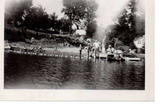
Figure 1. Pine Lake basin on 18 June 2014, two months after the dam failed. During summer 2014 the lake bed was colonized by meadow grasses and wildflowers, which persisted in 2015. The damaged dam is in place, and flood waters have partially and temporarily refilled the lake basin during intense rainstorms in 2014 and 2015.
Note that the Viviry River flows through the drained lakebed and a major tributary (Black Creek) flows under Cameron Road into the lake basin to join the Vivery just upstream of the present dam site. This is noteworthy because the Black Creek sub-basin accounts for30%oftheViveryRiverwatershed,whichsignificantlyincreasestheamountoffloodwaterreachingthepresentdamsite. In consideration of ongoing climate change this is worrisome in that only 27% of the Black Creek drainage basin is in Hudson — we do not control land development in the other 73% of the sub-basin that lies in St-Lazare and Vaudreuil-Dorion. Runoff and sedimentation into Black Creek will increase as land is developed in the sub-basin. Hence flood risk is likely to increase in future.
This scenario would LEAVE THE OLD DAM IN PLACE, which is the situation that has prevailed since April 2014. Based on ecological principles, old photos from before the dam was built, and vegetation presently upstream from the lake basin, the river shore likely will become a grassy meadow. Eventually an alder thicket will develop near the river edge and in low areas prone to flooding, and higher ground that is less likely to flood will be colonized by upland tree species. The riverside meadow and alder thickets will flood during storm events and snowmelt, conferring some degree of flood mitigation downstream. In the long run there is likely to be damming by beavers on the stretch of the river between St-Charles Road and Cameron Road; their dams will further reduce the peak flow during flood events.
Considerations
- This may not really be an option — we do not know if the ministry would allow leaving the stream obstructed by the old dam, or what requirements might be imposed in that case.
- If the damaged dam can be left in place it still needs to be stabilized and its ramshackle appearance made more presentable; the cost of this work is unknown.
- Some additional stabilization of the shoreline immediately adjacent to the dam will be required, i.e. along the berm on public land along Cameron Road and on Cynthia Maher’s property. The cost of this sort of work was included in the estimates prepared in May 2014 by EXP (cf. alternative #4)
- The dam in its present condition provides modest and unregulated flood control, which means peak floods in the future might cover Cameron Road at the Black Creek culvert, impeding traffic and weakening the roadbed.Flood risks are likely to increase in future due to both ongoing climate change and land development within the watershed
- The Cameron Road culvert and especially the Black Creek culvert may need to be replaced. The town will have responsibility to clear sediment and ensure good downstream flow in both culverts. Failure to maintain flow in these culverts poses some risk of the river washing out the roadbed during a flood event.
- We do not know if the ministry would allow routine clearing of sediment in culverts; restrictions may be imposed that complicate the work and increase the expense of sediment removal.
- At some point sediments will have accumulated in the lake basin to a point where dredging and recontouring of the old lake basin may be required to maintain even modest flood control; this work will require regulatory approval.
Tasks
- Do current Quebec and federal regulations allow leaving the broken dam in place? If so, what would be the cost to stabilize and approve the appearance of the structure?
- Would current Quebec and federal regulations allow routine, unrestricted cleaning of sediment in the culverts under Cameron Road? If sediment removal is allowed by government, then the frequency and costs of this routine work should be estimated and responsibility assigned to someone on the town staff.
- What liability, if any, does the town bear for any loss of property value associated with a failure to restore Pine Lake? What would be the consequent costs?
- Are there any government or public-private programs available for cost-sharing associated with this scenario?
- If this scenario were to be implemented, what would be the total estimated cost of the immediate work, including
interest paid on any loan required to complete the work? The operating costs over time?
- How would the cost be shared between subsidies, taxes levied on the town as a whole, and taxes levied on residents whose properties abut the lake?
Summary
Of all the scenarios, this one probably has the least financial cost in terms of immediate work and also in subsequent operational costs, but Pine Lake will not be restored. Hence there are political issues as well as questions of liability and recompense to nearby property owners to be considered.
Scenario 2: Remove the old dam, ± create a riverside park
REMOVE THE FAILED DAM: This scenario involves removing the failed dam at an estimated cost of at least ~$147,970 (cf. EXP consultation – May 2014), which will result in a free-flowing river; the riverside could either be left unmanaged or managed as a riverside park. Once the dam is removed, the Cameron roadbed with its culvert restricting high flow rates could essentially act as a check dam so long as the roadbed and shoulder were properly reinforced. That would back up some water to flood the riverside meadow during peak flow, but that temporary impoundment in turn would reduce the risk of downstream flooding.
Considerations:
- The EXP cost estimate for dam removal already includes some stabilization of the river channel and banks to withstand erosion during floods as the river flow converges on the culvert under Cameron Road.
- There will be ongoing operating costs to keep the culvert under Cameron Road clear of sediment to ensure good flow during storm and snowmelt events.
- Ministry approval will be required for the work to remove the dam, and perhaps also for any regular sediment clearance in the culvert.
- The risk of flooding Cameron Road at the Black Creek culvert should be assessed by a qualified professional; the roadbed and adjacent terrain may need to be raised in this low-lying section and the capacity of the Black Creek culvert increased. The EXP report did not consider this point; this section of road has flooded in the past.
- Any work on Cameron Road at Black Creek will block access to the village center; a detour at Mount Pleasant will be impossible, so only Bellevue and St. Charles will provide village access during the construction work.
- Since flood risks will increase in future due to ongoing climate change and land development, raising this section of Cameron Road and improving flow through the Black Creek culvert may be necessary. The costs and benefits would need to be evaluated, as well as the degree of urgency of the work.
- If substantial construction work were to be done along Cameron Road, there would be an opportunity to use available earth moving equipment to recontour areas adjacent to the river in order to convert the riverside into a public park. With proper redistribution of lakebed sediments parts of the park could be above flood levels and other parts allowed to flood to reduce downstream flood risks during storm and snowmelt events. Professional consultation would be required to coordinate the recontoured surface with the redesign of culverts or bridges on Cameron Road.
8. A sediment analysis would be required before moving and/or removing materials in the former lake bed, and the work would require ministry approval.
Tasks:
- If the lake bed sediments are to be disturbed, it may be necessary to provide the ministry a sediment analysis before any work will be approved. Inquiries should be made to the ministry regarding the requirements.
- If sediments are contaminated, the ministry could force their removal and proper disposal – consequent costs should be estimated.
- Would current Quebec and federal regulations allow routine, unrestricted cleaning of sediment in the culverts under Cameron Road? If sediment removal is allowed by government, then the frequency and costs of this routine work should be estimated.
- The risk of flooding over Cameron Road at the Black Creek culvert should be evaluated and necessity and urgency of remedial work considered.
- If a riverside park were to be developed, what would be the cost of its design, construction and maintenance?
- What liability, if any, does the town bear for any loss of property value associated with a failure to restore Pine Lake?
- Are there any government or public-private programs available for cost-sharing associated with this scenario?
- If this scenario were to be implemented, what would be the total estimated cost of the immediate work, including interest paid on any loan required to complete the work? The operating costs over time?
- How would the cost be shared between subsidies, taxes levied on the town as a whole, and taxes levied on residents whose properties abut the lake?
Summary
If the ministry requires removal of the damaged dam, we will be forced to assess and mitigate any risks to Cameron Road and/or downstream flood risks. There could be an opportunity to develop a riverside park for public enjoyment at relatively low cost while heavy machinery is on site, although with some temporary disruption of traffic along Cameron Road.
Scenario 3: Restore the old dam, recreating Pine Lake
Fig 3. The Viviry River and its tributaries; the yellow line delimits the watershed – rain and snow melt within the watershed boundaries contribute significantly to flow in the Viviry River. Tributaries flowing north into the Viviry are fed by a combination of surface runoff plus a significant amount of groundwater leaking from the St-Lazare Plateau, a shallow aquifer under the subwash fan deposited during the retreat of the Laurentide Ice Sheet ~9500 years ago. Groundwater in the St-Lazare Plateau mostly originates as rain and snow melt outside the Viviry River watershed. A similar combination of runoff and groundwater sources prevails in south-flowing tributaries originating on the Hudson Highlands, which are another subwash fan laid down by the melting ice sheet. Well-water drawn from these shallow aquifers will reduce flows into the Viviry River as future development increases water use. The solid red stars indicate positions of existing check dams that provide some flood control along the Black Creek tributary; open red stars indicate sites of old beaver dams that could be rebuilt into check dams along the main river channel.
RESTORE THE OLD DAM, RECREATING PINE LAKE: The EXP consulting report estimated the cost of repairing the 1990 dam that was damaged in May 2014 to be $462,707 but without provision for dredging the lake basin to create adequate flood control capacity and an ecologically viable lake ecosystem. Repairs to the 1990 dam combined with dredging of sediments and construction of check dams upstream might yield a healthy lake ecosystem and viable flood control, although given increasing flood risks this is not certain in the long run.
Considerations:
- The normal level of Pine Lake is set by the design of the dam; the original dam built in 1946 set the normal lake level at the 100 foot contour. This led to the lake water encroaching a meter or two onto some of the neighboring properties. The design of any new dam needs to consider the degree to which properties neighboring Pine Lake will or will not be under water at normal lake level and also during a flood.
- The concrete in the old dam is good (GHD report – September 2015), so lifting the old dam back into place, resealing the dam to the sidewalls, and repairing the damaged flood gate mechanisms should be possible.
- Repositioning and repairing the damaged dam could be combined with the insertion of ‘sheet piles’ just in front of the dam to reduce the chances of water undercutting the dam again in future; sheet piles are heavy-duty steel sheeting that can be driven into the ground to form a barrier to stabilize the substrate under the dam itself.
- A potential complication is that if simply restored this 1990 dam may not provide sufficient flood control in future, at least not without dredging of the lake basin. The AMEC report (September 2014) provides hydrological data not available in the May 2014 EXP report, but our calculations show that AMEC underestimated flood risk by not allowing sufficiently for the effects of future land development and climate change effects on storm intensity.
- In our opinion there is no point restoring the dam without dredging the lake basin – the present shallow, poorly contoured basin is prone to algal blooms and will provide inadequate flood retention capacity.
- Flood risks are likely to increase in future due to both ongoing climate change and land development. Climate change will bring more of the high-intensity storm events that pose the greatest flood risk, and these will be exacerbated by reduced infiltration on built land surfaces as land development in the watershed continues.
- Even if the lake basin is dredged, it is unclear whether restoring the dam built in 1990 without any modification will provide adequate control of flood risk in coming decades.
- Only 43% of the Viviry River watershed is in Hudson. Hudson does not have control over land development in the 57% of the Viviry River watershed that is located in Vaudreuil-Dorion and St-Lazare, much of which is not presently developed. Higher runoff rates are likely in future as land development proceeds in adjacent towns as well as in Hudson.
- Building of check dams could help reduce sediment loading into the dredged lake basin and improve flood control, in the immediate future or over time. Two upstream sites are suitable for construction of check dams, both previously dammed by beavers (cf. Fig 3). Construction of check dams would require ministry approval, although beavers need no approval so we might just encourage them to do the job at no cost to the town.
- Iflakebedsedimentsarecontaminatedandmustberemovedfromthesiteratherthanredistributedatthesite, then costs escalate significantly. The ministry will require analysis of the sediments and prescribe their disposal options. If the sediments are not contaminated and can simply be redistributed on site, then the operation will be less expensive.
- Shouldthisscenariobeadopted,thetownwouldhavebothresponsibilityandliabilityformaintenanceand management of the dam, including 24/7 proactive management of water flow during flood events.
Tasks:
- This scenario requires a more complete professional review that better defines the relationships between the dam as restored to its 1990 design, the dredging and contouring of the lake basin, and the consequent risk of flooding as climate change and land development proceed in coming decades. The three existing consulting reports do not comprise a complete and correct documentation of flood mitigation.
- Repairing and restoring the old dam would involve satisfying ministry regulations for the design, construction and subsequent management of the dam site. The policies, procedures and timeline should be investigated in detail.
- If the lake bed sediments are to be disturbed, the ministry probably will require a sediment analysis and a work plan before any work will be approved. Inquiries should be made to the ministry regarding the requirements.
- If sediments are contaminated, the ministry could force their removal and proper disposal – consequent costs should be estimated.
- Would current Quebec and federal regulations allow routine, unrestricted cleaning of sediment in the culverts under Cameron Road? If sediment removal is allowed by government, then the frequency and costs of this routine work should be estimated.
- Are there any government or public-private programs available for cost-sharing associated with this scenario?
- If this scenario were to be implemented, what would be the total estimated cost of the immediate work, including interest paid on any loan required to complete the work? The operating costs over time?
- How would costs be shared between subsidies, taxes levied on the town as a whole, and taxes levied on residents whose properties abut the lake?
Summary:
This scenario has a certain “just fix the dam and get back the lake ASAP” appeal, but things are not quite so simple. First, the EXP estimated cost advantage of restoring the old dam compared to building a new dam appears negligible, so building a new dam (i.e. scenarios 4, 5 & 6) designed for the 21st century rather than restoring a 1990 dam could be preferable. Second, both of these EXP estimates have hidden and uncertain costs for dredging and sediment removal, which would differ depending on the dam design. Third, neither estimate addresses the risk of flooding and the degree to which the completed project would mitigate flood risk in coming decades.
Scenario 4: Build a new concrete dam, recreating Pine Lake:
BUILDING A NEW CONCRETE DAM: The EXP report in May 2014 estimated the cost of removing the damaged dam and replacing it with a comparable, concrete dam to be $481,504, but without consideration of dredging and recontouring the lake basin to create adequate flood control and a more viable lake ecosystem. It also appears that the EXP estimate simply replicated the design of the 1990 dam, which does not take advantage of the opportunity to match design of the dam and the impoundment (i.e. the lake basin) for improved flood mitigation in coming decades.
Considerations:
- The normal level of Pine Lake is set by the design of the dam; the original dam built in 1946 set the normal lake level at the 100 foot contour. This led to the lake water encroaching a meter or two onto some of the neighboring properties. The design of any new dam needs to consider the degree to which properties neighboring Pine Lake will or will not be under water at normal lake level and also during a flood.
- The issues of dredging and control of flood risk apply whether the dam is restored or rebuilt, but a new dam could allow better coordination among the extent of dredging, the construction of check dams, and more recent estimates of future flood risks under climate change.
- There is no point restoring the dam without dredging the lake basin – a shallow, poorly contoured basin is prone to algal blooms and will provide inadequate flood retention capacity.
- Flood risks are likely to increase in future due to ongoing climate change and land development. Climate change will bring more of the high-intensity storm events that pose the greatest flood risk, and these will be exacerbated by reduced infiltration on built land surfaces as land development in the watershed continues.
- Only 43% of the Viviry River watershed is in Hudson; we do not control land development of the 57% of the Viviry River watershed that is located in Vaudreuil-Dorion and St-Lazare, much of which is not presently developed. Hence, higher runoff rates and greater flood risks are likely in future as land development proceeds.
- Building of check dams could help reduce sediment loading into the dredged lake basin and improve flood control, in the immediate future or over time. Two upstream sites are suitable for construction of check dams, both previously dammed by beavers (cf. Fig 3). Construction of check dams would require ministry approval, although beavers need no approval so we might just wait for them to do the job at no cost to the town.
- If lake bed sediments are contaminated and must be removed from the site rather than redistributed at the site, then costs escalate significantly. The ministry will require analysis of the sediments and prescribe their disposal options. If the sediments are not contaminated and can simply be redistributed on site, then the operation will be less expensive.
River flow
Fig 4. Cross-section of the dam and culvert under Cameron Road (cf. AMEC consulting report). The lake and dam are to the left, with water flowing through the culvert beneath Cameron Road (culvert below the shaded roadbed). a town water main lies somewhere below or to the side of the road, but is not shown; work in this area must ensure the water main is not subject to freezing in winter.
Should this scenario be adopted, the town would have both responsibility and liability for maintenance and management of the dam, including 24/7 proactive management of water flow during flood events.
Tasks:
- Building a new concrete dam would involve satisfying ministry regulations for the design, construction and subsequent management of the dam. The policies and procedures should be investigated in detail.
- If the lake bed sediments are to be disturbed, it will be necessary to provide the ministry a sediment analysis before any work will be approved. Inquiries should be made to the ministry regarding the requirements.
- If sediments are contaminated, the ministry could force their removal and proper disposal – consequent costs should be estimated.
- Would current Quebec and federal regulations allow routine, unrestricted cleaning of sediment in the culverts under Cameron Road? If sediment removal is allowed by government, then the frequency and costs of this routine work should be estimated.
- Are there any government or public-private programs available for cost-sharing associated with this scenario?
- If this scenario were to be implemented, what would be the total estimated cost of the immediate work, including interest paid on any loan required to complete the work? The operating costs over time?
- How would the cost be shared between subsidies, taxes levied on the town as a whole, and taxes levied on residents whose properties abut the lake?
Summary:
Given the information available, we are unclear on the relative advantages of repairing the old dam vs building a new dam, but there is more uncertainty associated with the cost and efficacy of the repair. On balance, replacing the damaged dam built in 1990 with a new concrete dam is probably the better of the two options. There would be a cost in demolition of the old dam, but also a significant benefit in more effective design and management of the entire system to function under a heightened risk of floods in future due to both land development and climate change.
Scenario 5: Build an earthen dam, restoring a smaller Pine Lake:
BUILD AN EARTHEN DAM, RESTORING A SMALLER BUT DEEPER PINE LAKE: The EXP report in May 2014 estimated the cost of removing the 1990 dam and replacing it with an earthen dam (i.e. in French a digue as opposed to a barrage) to be $440,113, but without consideration of dredging and recontouring the lake basin to create adequate flood control capacity and an ecologically viable lake ecosystem.
EXP did not specifically show the placement or design of their earthen dam, which could take many forms. One possible design essentially replicates the original dam built in 1946 (c.f. photos #1 and #2 in Appendix 1): an earthen dam parallel to Cameron Road. The 1946 dam had a concrete spillway at the site of the 1990 dam, with the lake water level controlled simply by insertion of barriers into slots in the spillway walls. This design requires the sill of the spillway to be below the present level of Cameron Road at the Black Creek culvert, which we believe unduly restricts the possibility of optimizing the design of an earthen dam relative to present and future flood risks. We subsequently present scenario 6 as a variant on this alternative that secures greater flood control by diverting the flow of Black Creek.
In the present scenario we move the earthen dam upstream (cf. Fig 5), dredge a deeper but smaller lake basin, and use the spoils to construct the earthen dam as well as an accessible southern shoreline and parking spaces along Cameron Road. By adding a bridge over the spillway, the top of the earthen dam could serve as a walkway connecting to a public trail on existing town land at the end of Cedar Avenue. In this design the area below the earthen dam would be either a meadow or public park with Black Creek running through it as an open stream, perhaps with a small pond or marsh at some point. The Viviry River would provide a natural barrier between the park and adjacent private properties; the spillway could be built as a cascade, improving stream water quality and adding a water feature to the park. Since Black Creek would enter the Viviry downstream of the earthen dam, the flow from Black Creek during flood stage would not impose added flood risk for the earthen dam. The deeper lake would be less prone to algal blooms and provide better fish habitat.
Fig 5: To have adequate stability earthen dams have to be wider than a concrete dam, hence some part of the old lake basin will be taken up by the earthen dam itself and the lake necessarily will be somewhat smaller. There is flexibility in placement of the dam; this working scenario places the dam in line with Cedar Avenue so that a trail on town land could provide lake access. The trail would cross the spillway on a footbridge and follow the dam to the southern shoreline. With this placement the height of the earthen dam would be such that the lake would be visible from Cameron Road with the Viviry River and Black Creek flowing through the park in the foreground. The east-facing side of the earthen dam seen from Cameron Road would look like a grassy hillside.
Considerations:
- The normal level of Pine Lake is set by the design of the dam; by agreement of the landowners the original dam built in 1946 set the normal lake level at the 100 foot contour. This led to the lake water encroaching a meter or two onto some of the neighboring properties. The design of any new dam needs to consider the degree to which properties neighboring Pine Lake will or will not be under water at normal lake level and also during a flood.
- Any design for an earthen dam requires more professional assessment than has been done by EXP. We have only outlined a possibility for consideration and discussion, not a complete analysis of the efficacy and costs.
- By their nature earthen dams occupy more ground than concrete dams; it is the mass of the earth that holds back the water. An earthen dam must be very well sealed and the face protected against degradation – any leak in the dam or flow over the top of the dam can quickly lead to failure, which will cause serious risk to life and property downstream as the lake empties through the breach.
- Placing the dam upstream from the point where Black Creek enters the Vivery River reduces the risk of failure of the earthen dam in an extreme flood events.
- Building check dams upstream also could help reduce sediment loading into the dredged lake basin and improve flood control, in the immediate future or over time. Two upstream sites are suitable for construction of check dams, both previously dammed by beavers (cf. Fig 3). Construction of check dams would require ministry approval, although beavers need no approval so we might just wait for them to do the job at no cost to the town.
- Flood risks are likely to increase in future due to ongoing climate change and land development. Climate change will bring more of the high-intensity storm events that pose the greatest flood risk, and these will be exacerbated by reduced infiltration on built land surfaces as land development in the watershed continues.
- Hudson does not have control over land development of the 57% of the Viviry River watershed that is located in Vaudreuil-Dorion and St-Lazare, much of which is not presently developed. Higher runoff rates are likely in future.
- If lake bed sediments are contaminated and must be removed from the site rather than redistributed at the site, then costs escalate significantly. The ministry will require analysis of the sediments and prescribe their disposal options. If the sediments are not contaminated and can simply be redistributed on site, then the operation will be less expensive.
- The flat top of the earthen dam could provide lakeside access from a footpath at the end of Cedar Avenue, but even with a railing there might be some associated risk of children slipping into the lake
- Therestoredlakewouldbesmaller,butdeeper.TheareabelowthedamwouldbeameadowwithBlackCreek running through it. This area would not be under water except during floods when Black Creek might overflow its banks, so it could potentially be landscaped and maintained as a roadside park.
- Shouldthisscenariobeadopted,thetownwouldhavebothresponsibilityandliabilityformaintenanceand management of the dam, including 24/7 proactive management of water flow during flood events.
Tasks:
- The scenario requires professional assessment if it is to be seriously considered.
- If the lake bed sediments are to be disturbed, it may be necessary to provide the ministry a sediment analysis before any work will be approved. Inquiries should be made to the ministry regarding the requirements.
- If sediments are contaminated, the ministry could force their removal and proper disposal – consequent costs should be estimated.
- Would current Quebec and federal regulations allow routine, unrestricted cleaning of sediment in the culverts under Cameron Road? If sediment removal is allowed by government, then the frequency and costs of this routine work should be estimated.
- What liability, if any, does the town bear for any loss of property value associated with a failure to restore Pine Lake to its original dimensions?
- Are there any government or public-private programs available for cost-sharing associated with this scenario?
- If this scenario were to be implemented, what would be the total estimated cost of the immediate work, including interest paid on any loan required to complete the work? The operating costs over time?
- How would the cost be shared between subsidies, taxes levied on the town as a whole, and taxes levied on residents whose properties abut the lake?
- If a riverside park along Black Creek were to be developed, what would be the cost of its design, construction and maintenance?
Summary:
There are some merits in an earthen dam, although the costs and benefits have a lot of uncertainty. Earthen dams have demanding operation requirements, and high liability risk if the dam is not well-maintained. In the scenario presented there may be some gain in flood control but the areal surface of the lake will be diminished, although its aesthetic and ecological value may be improved by its greater depth. Development of a park along Black Creek and the southern lakeshore would provide some public amenity. In any case, it is clear this scenario or any related variant would require significant preliminary investment of time and money to properly plan.
Scenario 6: Divert Black Creek to enter the Viviry River below the present dam site
DIVERT BLACK CREEK in combination with an earthen dam on Pine Lake. EXP did not consider the possible diversion of Black Creek, which presently accounts for 30% of the water flowing into the Viviry River; this amount will increase with future land development in Black Creek watershed, only 27% of which is under the control of Hudson. Developments in the Vaudreuil- Dorion and St-Lazare portions of the watershed will increase future runoff into Black Creek, increasing rates of sedimentation into Pine Lake and complicating management of flood waters. Hence it is worth considering diverting Black Creek ( Figure 8a) so that its sediment load enters the Viviry below the dam where it can be carried downstream to the river mouth; this also allows scaling down the size of the dam required for flood control at the Pine Lake dam. This scenario raises up the low point on Cameron Road, brings Black Creek under the raised road and over to the Viviry River in a covered culvert that runs beneath a raised shoreline like the present berm parallel to Cameron Road. The northern end of the earthen dam could either be either a simple concrete spillway or a concrete dam with flood gates. Additional flood control would be provided by an overflow gate in the culvert wall that could be opened during a flood event to reduce flow over the sill of the dam; this overflow gate would allow the lower reach of Black Creek up to and below Meadowbrook School to function as a supplemental retention basin during peak flood, hence reducing downstream flood risks on the Vivery River (cf Figure 8b). The flooded land along Black Creek mostly is publicly owned and much of it is already marshland. The town might consider purchase of four fragments of property in private ownership on the south shore of the small pond on Black Creek just upstream of Cameron Road (cf. Figure 7). This would provide a direct connection between the parking and public amenities at Pine Lake and the Taylor Bradbury trail, creating a pleasant hike along Black Creek all the way to Como Golf Course and the town trails in Davidson Park.
Fig 6: Diversion of Black Creek to enter the Viviry River downstream from the dam showing the route of the diversion and a cross-section of the covered culverts that would carry the flow underground between the lake shore and Cameron Road. Drawing by Ken Walker.
- The normal level of Pine Lake is set by the design of the dam; the original dam built in 1946 set the normal lake level at the 100 foot contour. This led to the lake water encroaching a meter or two onto some of the neighboring properties. The design of any new dam needs to consider the degree to which properties neighboring Pine Lake will or will not be under water at normal lake level and also during a flood.
- The hydraulics involved in managing peak flows during flood stage could be challenging. The combination of water flowing over the sill of the dam and through the Black Creek culvert when the overflow gate was opened might threaten the integrity of existing culverts and bridges downstream at Main Road, the CP tracks and Royalview Avenue. But if the elevational relationships are managed correctly, water could enter the lower reach of the Black Creek basin (i.e the Driscoll-Naylor Bird Sanctuary and the marsh upstream of the sanctuary), relieving flood risk in Pine Lake without undue risk downstream on the Viviry River.
- Flood risks are likely to increase in future due to ongoing climate change and land development
- It may be that diversion of Black Creek flow combined with flow over the dam during a flood event will exceed the capacity of the Cameron Road culvert. Flood flow from Black Creek that previously would have entered Pine Lake, would now move unimpeded into the Viviry River channel. Hence, it may be necessary to increase the capacity of the Cameron Road culvert or replace it with a bridge.
- A bridge would have greater capacity to move water downstream, but in turn that may threaten existing culverts and bridges at Main Road and the Canadian Pacific railroad tracks, and perhaps the bridge at Royalview Avenue. There is also a risk of freezing a water main supplying the village; the pipe is buried along Cameron Road and apparently could be exposed as it runs under the bridges. Professional consultation is required.
- The present sediment load in Black Creek is unknown, although it is probably low because of the settling basin in the Taylor Bradbury bird sanctuary upstream. If the culvert diverting Black Creek were to fill with sediment, could the flood gate in the earthen dam simply be opened occasionally to flush away the sediments in the covered culvert as well as those further downstream in the Vivery River?
- Should this scenario be adopted, the town would have both responsibility and liability for maintenance and management of the dam, including 24/7 proactive management of water flow during flood events.
Fig 7. Four small properties on the south shore of Black Creek Pond of little or no value to their owners could be bought to connect Pine Lake to existing town trails along Black Creek that in turn connect to Davidson Park and Como Golf Course.
|
Figure 8a. Pine Lake and the pond in Black Creek at Cameron Road with normal water levels; the inset shows detail near the dam. See Fig 8B for the situation during a flood. The legend applies to both images, which were created by Anna Luz in Martin Lechowicz’s research group. |
|
Figure 8b. The lower reach of Black Creek as an auxiliary retention basin. During major floods the town could open the overflow gate in the side of the Black Creek culvert to let water drain from the lake to reduce the risk of the dam failing. Lake water would then flow through the Black Creek culvert into the Viviry below the dam and also spill upstream in Black Creek to flood the marshy areas associated with the Driscoll-Naylor Bird Sanctuary. Periodic flooding would be advantageous to the marsh vegetation and provide temporary flood retention capacity without risk to residential properties.
Tasks:
- This scenario requires careful professional assessment with a focus on cost-benefit analysis amortized over 30 years that allows for both the effects of heightened flood risk under climate change and increased runoff associated with future land developments throughout the Viviry River watershed.
- Ministry approval would be required for all aspects of this work – design of the dam and diversion, associated work on Cameron Road, dredging and relocation of sediment etc. The relevant regulatory constraints and required documentation require careful investigation in advance.
- Would the owners of fragmented properties on the south shore of Black Creek just above Cameron be willing to sell their property to the town for a reasonable price? The fragments are small and separated from the larger part of their lots, so have little value to them but potentially high value to the town in terms of flood regulation and trail access.
- What liability, if any, does the town bear for any loss of property value associated with a failure to restore Pine Lake?
- Are there any government or public-private programs available for cost-sharing associated with this scenario?
- If this scenario were to be implemented, what would be the total estimated cost of the immediate work, including interest paid on any loan required to complete the work? The operating costs over time?
- How would the cost be shared between subsidies, taxes levied on the town as a whole, and taxes levied on residents whose properties abut the lake?
Summary: This scenario recreates Pine Lake much as it was prior to 2014, but with an improved shore along Cameron Road, allied improvements to Cameron Road itself, enhanced flood control, and reduced rate of sedimentation in the lake. If the four fragments of private property on the southern shore of Black Creek Pond were acquired by the town then the land along the shore of Black Creek also would allow direct connection of the parking and lakeside amenities at Pine Lake to the trail that follows Black Creek all the way to the Como Golf Course and Davidson Park. Although this scenario requires professional review and cost analysis, it would return Pine Lake to its former area but with better flood control and connection to town hiking trails. The cost-benefit ratio could be favorable when amortized over 30 years when flood risks will steadily increase with climate change and land development in the Viviry River watershed.
Using the criteria that organized our discussions, the Pine Lake working group arrived at a consensus ranking of the six scenarios we considered. Our mandate asked us to “…to provide Council with a recommendation as to what type of dam(s) could be constructed taking into account various factors that have bearing on the choice of a type of structure” and we have done so, but we wish to emphasize three points:
- This is NOT a final ranking and recommendation, only our sense of where things stand given the incomplete information available at this time.
- Some additional information and professional advice is required before a well-informed and definitive choice can be made among these six scenarios and any others that may become available.
- The ultimate responsibility for a decision on the future of Pine Lake rests with the Mayor and Council – we respectfully submit this report to assist their deliberations on the best way forward.
