Hudson’s indefinite-closure crisis

That was Then, c. 1960. Hudson town wharf looking east to the Hudson Marina

This is my submission to the public consultation (Wednesday, Oct. 23/24) on the Town of Hudson’s proposed parks and greenspaces policy.

With this past week’s indefinite closure of Hudson’s historic steamboat landing at the foot of Wharf Road, residents and visitors lose another window on the Ottawa River. I don’t hold out much hope that it will ever reopen, given the extent of its deterioration.

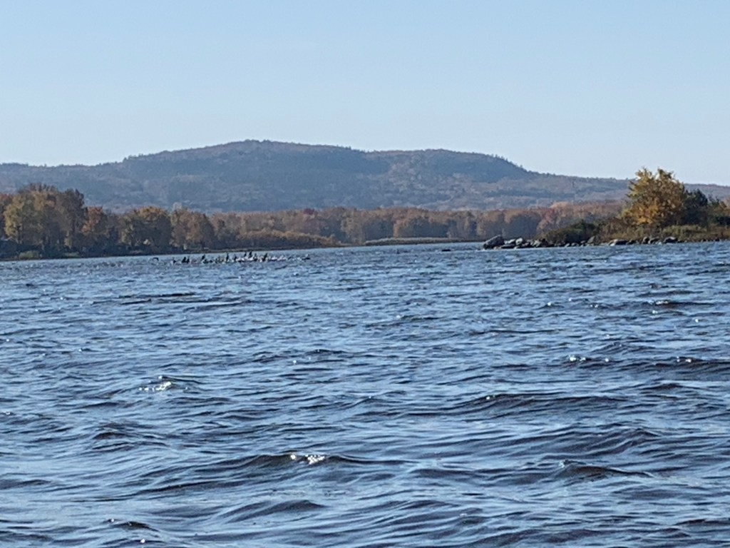
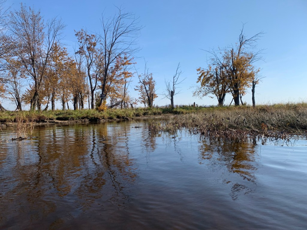
The preservation of a crumbling 19th-century town wharf may be no big loss for some, but this indefinite-closure thing is becoming a trend, what with the posting of Sandy Beach and now the barricading of the footbridge which used to be the sole public access. Unless you’re a Hudson Yacht Club member, the only remaining public access to Hudson’s 14 kilometres of waterfront is via Jack Layton and Thompson parks.

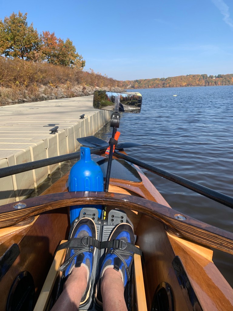
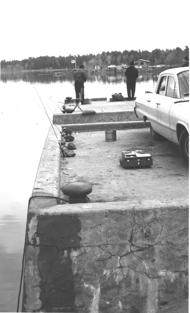
Hundreds of boaters depend on the JLP launch ramp, dock and the nearby cove. The dock was widened under the previous administration, but the ramp hasn’t changed since Dudley Reid and Lucien Mallette opened a marina on the location of the massive Wilson Company icehouse where Canadian Pacific once loaded blocks of ice from the Ottawa River into reefer cars to transport perishables in the time before refrigeration.

Those of us who use the ramp are immeasurably grateful for the privilege. (Use of the ramp is free because the last council determined that it doesn’t conform to standards that would justify charging people. Instead, we use it at our own risk.) It’s self-policing; people wait their turn regardless of the size and value of their craft.

Hudson worked out a deal with St. Lazare that would allow residents of both municipalities a free annual permit and nearby parking privileges. In return, Hudson residents enjoy free access to Les Forestiers and its well-maintained ski and walking trails. For $125 a year, Vaudreuil-Soulanges residents can buy the right to park nearby; for everyone else, it’s $250 unless they choose to park free at the snow dump, a five-minute walk. Use of the park is free for all.  

Our council looked at Thompson Park as an alternative to JLP for non-motorized craft. The problem is getting one’s boat to the water’s edge, a football field’s distance and a steep hill away, most of it within the 100-year floodplain. We had serious doubts the environment ministry would approve construction of a road, a parking lot near the water and a dock. As well, the sandy shoreline quickly grows an impenetrable thicket of aquatic vegetation that would require regular cutting. We agreed it wasn’t a sustainable solution. 

We took a closer look at the former marina. If mayor Liz Corker’s council made the decisions necessary to begin its transformation, the artistry of landscape architect Brian Grubert and stonemason Bob Houghton turned it into a riverside gem while preserving its vocation as a boat launch with public parking. 

How could we expand its use? Council mandated the parks and recreation department to come up with a survey detailing how other waterfont municipalities manage access to users and residents. A local business proposed a boat rental kiosk similar to the operation at Vaudreuil-Dorion’s Valois Park. Our regional Caisse Desjardins offered to fund a separate launch at the east side of the park where kayakers and paddleboarders could launch and recover their craft without having to queue up with the powerboaters. 

A council majority ended up rejecting all suggestions, based on the probability that the environment ministry would probably says no. End of discussion.

Barricaded indefinitely: bureaucratese for closed forever?

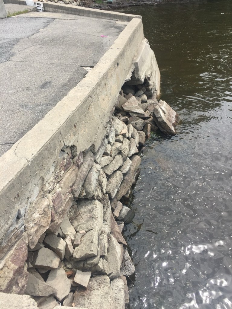
When news broke of the wharf’s closure, Bob Houghton had an interesting suggestion. Why not continue what Mother Nature began, knock down the crumbling concrete and backfill with boulders as he and Grubert did with the icehouse site? It would allow the creation of a waterfront promenade on the footprint of the original wharf, typical of the commonsense simplicity that once graced Hudson’s approach to problem-solving. The environment ministry could hardly reject a project built on what was. 

But would residents support a relatively low-cost proposal that would give us another window on the lake when previous plans to repurpose the wharf went nowhere? A 2019 a Canadian Coast Guard proposal would have seen the wharf turned into a much-needed base on the Lake of Two Mountains. Wharf Road residents objected, council was wary of hidden costs to taxpayers and the Coast Guard went elsewhere. Last year, I wrote about how one of the subcontractors for the new Ile aux Tourtes bridge proposed to assemble components in the town snow dump, transport them to the wharf, and ship them to the site by barge (www.thousandlashes.ca/23/06/06). In exchange, the town would get a rebuilt wharf.

The plan was scrapped because the wharf was too far gone.

Meanwhile, other municipalities recognize the social and economic value of accessible public waterfronts. Pointe Claire has its waterfront walk and pier where the Edgewater Inn once stood. Ile Perrot transformed a crumbling seawall into public access. Les Cedres and Pincourt revitalized their small-boat launch facilities. Oka added small-boat docks to its well-maintained public wharf opposite the Hudson-Oka ferry landing. It’s not the cost, but the political vision required to see the value in expanding public waterfront access.

Why should Hudson maintain, even increase public access to its waterfront? 

Boat ownership is quickly moving away from parking one’s boat in a yacht club or marina. It’s both generational and about how people want to spend their money. Paddleboards, canoes and kayaks are relatively inexpensive, easily moved on rooftop racks anywhere with public parking where they can be launched and hauled out. It’s also a a matter of freedom; boats on cartops or trailers and in pickup beds can be stored on one’s property (with some bylaw exceptions) and driven to any body of water with a public ramp.

In light of the exploding interest in low-overhead boating among enthusiasts who may live nowhere near the water, the Montreal Metropolitan Community is encouraging riverfront municipalities to clean up their shorelines and add launch facilities, preferably with non-motorized boat rentals and maps of local waters registered with the MCC’s aspirational Blue Corridor, the paddle/oar community’s vision of a network of boating routes through the hundreds of islands surrounding Montreal. 

At the same time, more and more waterfront municipalities are restricting access to their launch facilities in response to residents complaining about the small-boat invasion. It boils down to making one’s facilities either pay per use or open only to passholders. Like Hudson, a handful offer launch facilities open to all with restrictions on parking, but all draw the line at overnight camping. I’ve seen waterborne travellers stealth camping at Hudson’s Thompson Park and Lachine’s Stoney Point and there are safe places to pull out if one knows where to look, but municipalities see these outliers the same way they look on homeless encampments — with suspicion. 

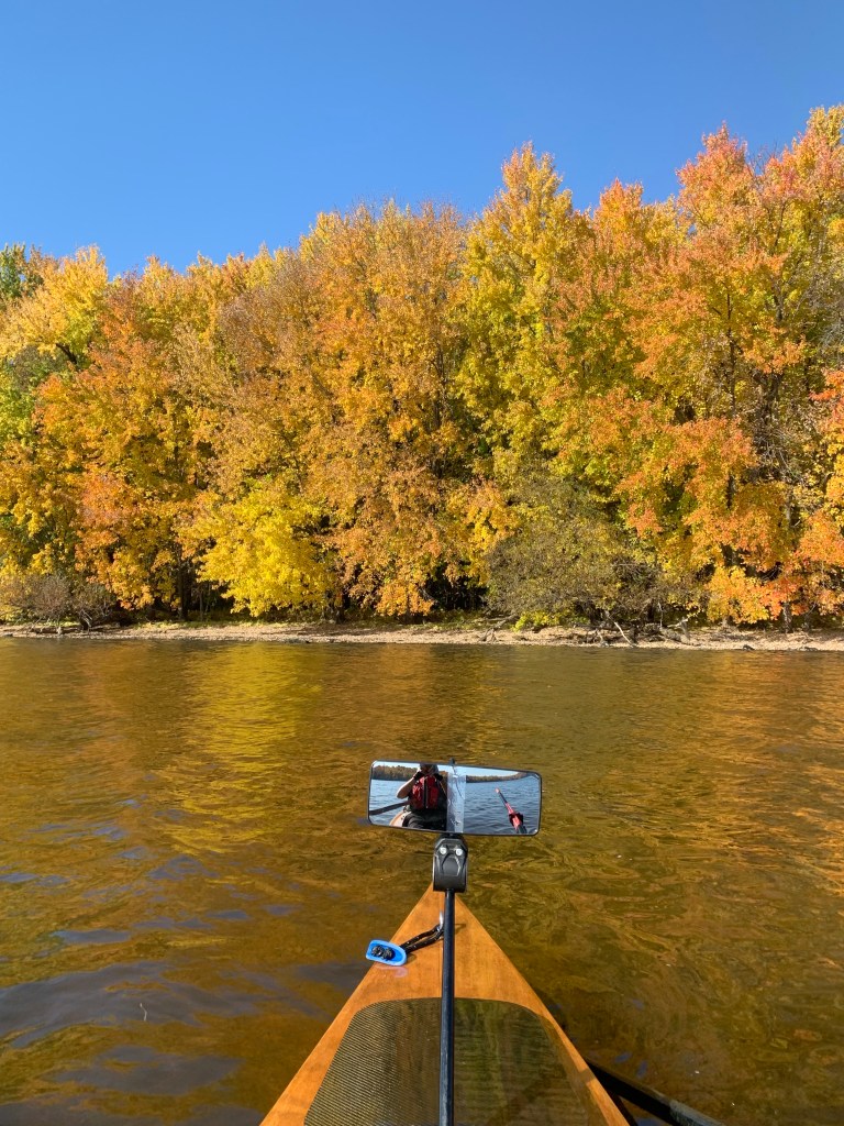
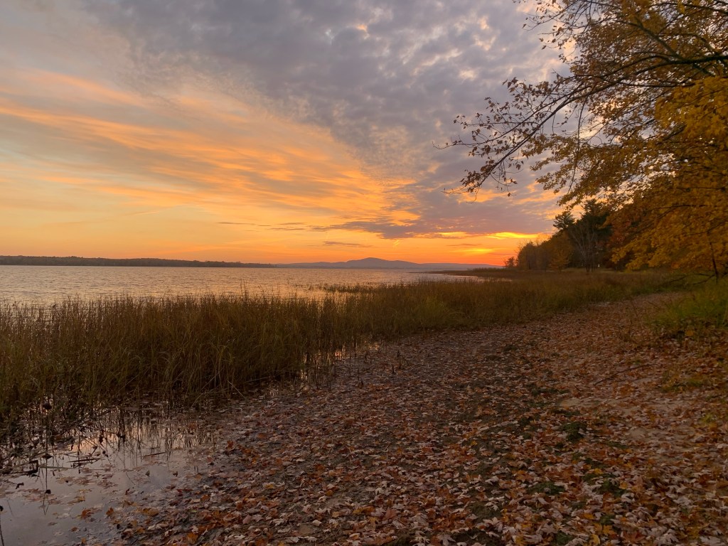
The problem with nostalgia is that most Hudson residents have no memory of what was. As kids growing up in Hudson’s waterfront, we grew up building driftwood rafts and poling them with saplings. As we grew older, we acquired our first boats and roamed further afield to Oka Beach and the sandbars off Carillon Island. Most of us learned to swim off whatever wharf or dock we had access to. 

Hudson’s public access to these simple pleasures is under increasing pressure from too many conflicting demands. Rather than accepting their closure, we should be investing in maintaining, upgrading, expanding and exploring alternatives.

In search of wilderness

Approaching Carillon Island from the south: a late-season overnight camping cruise reveals the wetland wilderness half a day’s journey from Hudson’s Jack Layton Park boat launch.

Earlier this week I took my boat upriver on a late-season camping trip to the islands, bays and wild spaces below the Carillon hydro dam. I began these forays when I was in my teens, drawn by the pull of wetland wilderness. I would make camp on one of the sandbars and beaches.

In late October, the only boats on the water are the fisherfolk and my 18-foot Angus Expedition, a rough-water sliding-seat rowboat designed by B.C.’s Colin and Julie Angus. In the hold are my tent hammock, sleeping bag, cooking gear, food and water, plus extra kit in case of a turn in the weather. In my lifejacket I carry a handheld VHF radio (the fisherfolk always have their ears on), strobe, cellphone (music!) and survival basics. As Coast Guard rescue jumpers put it, if you’re not wearing it you don’t have it.

Louise pushed me off from the Jack Layton Park dock before 8 a.m. The forecast was sunny and breezy, with winds from the southwest between 20 and 40 km/hr., so I hugged the Hudson and Rigaud shorelines to take advantage of the shelter they provided from the wind. Waterfront mansions gave way to modest cottages, many raised or on stilts after the epic 2017 and 2019 floods.

Gulls have taken over the sandbar at the mouth of the Raquette River. Four years ago, this was a shorebird hangout

The Raquette estuary marks the division between civilization and wilderness. The gulls have now taken over the sandbar since my last visit in 2020; they sounded a raucous alarm as I rowed past. Around the next promentory was a surprise — a quiet bay, bisected by a manmade peninsula and at its end, a stone cottage, clearly predating environment ministry edicts about what one can and can’t do in a floodplain. It’s boarded up for the season but in good repair. I can understand why someone would want that view, across the Lake of Two Mountains to the westernmost mount the Mohawks believe is sacred.

Stone cottage on the Rigaud side evokes the golden age.

I continued upriver, past Rigaud’s Grand Quai, clusters of waterfront homes where residents continue their struggle against the river and the environment ministry’s latest floodplain map. Many are either raised or armoured against flood-borne ice with breakwaters. The goal is finding ways to prevent Quebec from justifying demolition of one’s home if it is seriously damaged in the next flood.

Four hours after pushing off from the JLP dock, I rounded the corner at the upper end of Carillon Island. This marks the junction of three rivers where the fluorescent yellow Rigaud and the polluted North River both discharge into the Ottawa, relatively clear after its trip through Hydro Quebec’s turbines.

Waterfront homes: floodproofing measures are underway in earnest as Quebec looks to rewild vulnerable sectors.

Ten kilometres long, less than a kilometre at its widest, Carillon Island has three faces. The south side is a primal forest of trees in riotous fall colours. There’s no evidence of human habitation.It’s another story on the north side, where well-kept summer chalets are perched well above the highest floodline and rough-hewn shanties taking their chances. There’s an underwater electrical cable to the island, so I suppose one could live here year-round.

Mont Rigaud from the northeast: Rigaud and North rivers feed into the Ottawa from both sides.

Emergency access is the dealbreaker. There’s an old concrete dock, but no indication it’s still in use. In the four months between freezeup and thaw, access by water isn’t possible. In the 19th century, inhabitants risked their lives crossing the ice to Terrasse Robillard on the north side or to Rigaud Bay to the southwest. With the advent of warmer winters and thinner ice, I’m not sure it’s any different with snowmobiles and ATVs.

My destination for the night — Carillon Island’s migratory bird sanctuary at the eastern end of the island. It’s a kilometre from the closest habitation, with an ATV track to the main beach and a collection of broken chairs and fire rings where the summer folk party. I found a cozy cove a fair distance from partyville where I could pull Gus well up on the beach and pitch my tent hammock five feet away. Perfect — as long as one can live with the avian party going on.

Gus pulled well up on the beach 10 feet from my Exod Monolith tent hammock: minimizing impact on a sensitive wetland.

Every year at this time, massive flocks of Canada geese, ducks and other wildfowl home in on Horseshoe and Carillon bays. Late into the night, one is treated to the sound of excited birds welcoming their relatives at they fly in long past dark. After sunup, they spread out to fatten up on acres of ripe duck corn for the next leg of their migration.

Sundown was blessedly bug-free but the October chill brought out a puffer jacket as I heated up Louise’s chili. After 25 kilometres of rowing against a headwind, I was ready for my sleeping bag before 8 p.m.

Predawn on Carillon Island looking east: a four-hour row back to JLP.

Morning brought another surprise. Overnight, the wind had shifted 180 degrees. Now it was out of the northeast, straight into my face on the row back to Hudson. Wind against current equals shorter, steeper waves. I girded for the pull with oatmeal, homemade beef jerky and a pot of strong coffee before loading everything into Gus and pushing off. 

Pelley Island trees are pruned into grotesque shapes by spring ice buildup

In a small boat, one looks to minimize the effects of wind and wave, which meant following the line of weedy sandbars and islets stretching from the foot of Carillon Island through the Pelleys to Hay Island, then across the south channel to Graham Island, a rocky outcrop off Hudson’s Rousseau St. Four hours and 22 kilometres after starting out, I pulled up to the JLP dock where Louise was waiting to stand watch on Gus while I went home to get the trailer.

Back at the JLP dock at the end of a beautiful two days in a wetland wilderness.

°°°°°°

This isn’t everyone’s idea of a good time. A good boat and equipment are prerequisites, plus It’s a fair amount of work. The payback is a winter’s worth of memories — the sight of a massive orange hunter’s moon rising above the sacred mountain, the indescribable emotion of being far from civilization yet close to home. Even the sound of excited geese.

As this world grows crazier and less hospitable, short escapes to wild places will grow in importance. By all means, write and enforce rules needed to protect them from overcrowding and vandalism, but don’t put them beyond the reach of those without the means.

24 hours to react

Irony of ironies: Quebec environment ministry’s revised floodplain map for Hudson will impact some 250 property owners whose homes may no
longer be rebuildable or insurable — but it does not include the slice of Sandy Beach adjacent to Beach Road.

Shocking news in this morning’s La Presse: thousands of Quebec residents have 24 hours to learn whether their homes are included in the government’s latest government floodplain maps.

“Their houses will be worth nothing,” a clearly perturbed Vaudreuil-Dorion mayor Guy Pilon tells La Presse’s team. Almost 2,000 homes in Pilon’s city are included in the environment ministry’s revised charts. Schools, seniors residences and the city’s water filtration and wastewater treatment facilities are included in Quebec’s new 350-year flood zones.

What’s especially disturbing is how Environment Minister Benoît Charette unveiled the changes in June without releasing the interactive website geoinondations.gouv.qc.ca which allows every municipality and residents to see for themselves who will be affected before the end of the public consultation process.

That process runs out on Thursday, Oct. 17, 2024 — tomorrow. 

The Montreal Metropolitan Community, which represents 82 Greater Montreal cities and towns, put together their own interactive map showing who in the MMC would be affected, but appears to have done little to alert member municipalities of the extent of the impact on their residents.

For the average resident, neither interactive map is user friendly. However, the geoinondations.gouv.qc.ca application includes civic addresses, which allows the user to get a feel for the number of people whose lives will be impacted — and to see who’s in the new red zone.

Hudson hit hard

The Town of Hudson risks losing several hundred millions in property values, depending on whether the structures affected can be insured, mortgaged or sold. Given the disproportionate worth of lakefront properties, the town’s $2.2 billion valuation roll will almost certainly take a hit.

Starting with 896 Main at the foot of Montée Lavigne, some 250 properties fall either partly or totally within Quebec’s new red zone. All but a handful were untouched by the 2017 and 2019 floods. They include mansions (the multimillion-dollar structure at 814 Main falls partly into the red zone) and cottages as well as most of the town’s sewage treatment facilities, the Hudson/Oka ferry and landmarks like the Hudson Yacht Club, Willow Inn, Greenwood and sections of Main Road itself. 

Entire neighbourhoods may lose the right to build, rebuild or be compensated for future losses, including Hodgsonville and all but two homes on Quarry Point. While structures of the south side of Main Road are generally spared, the red zone reaches far inland along wetlands in the east and west ends.

Ultimate irony: most of Sandy Beach along Beach Road is on high ground, well above the new high-water mark.

Climate change

Why is François Legault’s CAQ government resorting to these draconian measures? Quebec hopes to avoid having to compensate residents and municipalities for damages incurred as the result of rapidly changing climatic conditions. The torrential rains from Hurricane Debbie were a wakeup call for municipalities far from major bodies of water and resulted in cities and towns rushing to revise their urban planning bylaws in response to pressure from the insurance industry.

Glossary from geoinondations interactive map: Quebec wants out of paying compensation for climate change fallout.